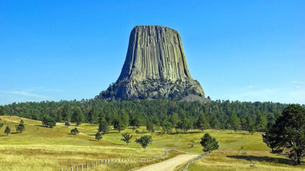
A Travel Guide to Black Canyon of the Gunnison National Park
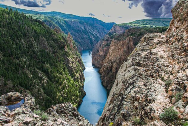
Black Canyon of the Gunnison National Park, located in western Colorado, is a breathtaking destination known for its dramatic, steep-walled canyon carved by the Gunnison River over two million years. Often described as Colorado’s “hidden gem,” this park offers stunning geology, thrilling outdoor activities, and serene solitude due to its relatively low visitor numbers (approximately 335,000 in 2024, making it one of the least-visited U.S. national parks). With sheer cliffs, ancient rocks, and a river roaring through a narrow gorge, the park is a must-visit for adventurers, nature lovers, and those seeking a quieter alternative to the Grand Canyon. This guide will help you plan an unforgettable trip.
Why Visit Black Canyon of the Gunnison?
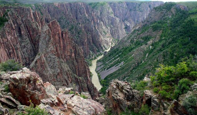
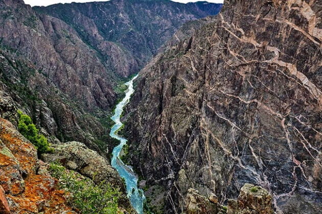
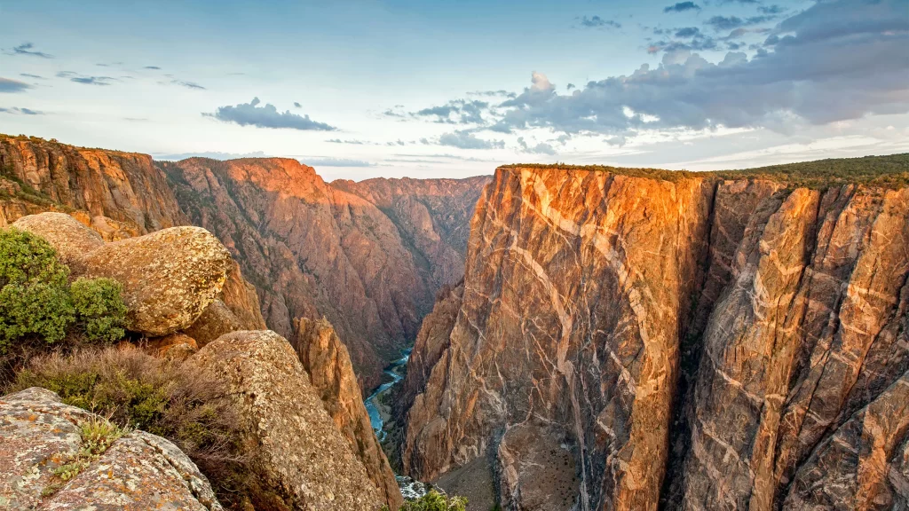
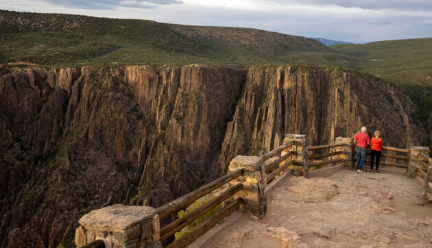
The park’s defining feature is its deep, narrow canyon, with walls of Precambrian gneiss and schist dating back nearly two billion years. At its deepest point, Warner Point, the canyon plunges 2,722 feet, and at its narrowest, it’s just 40 feet wide at the river. The canyon’s steepness limits sunlight to some areas—hence the name “Black Canyon,” as shadows make the walls appear dark. Key highlights include:
Geological Marvels: The Painted Wall, Colorado’s tallest cliff at 2,250 feet, showcases pink pegmatite veins cutting through dark metamorphic rock. Wildlife and Nature: Spot peregrine falcons, golden eagles, bighorn sheep, and diverse flora, from Gambel oaks on the rim to cottonwoods along the river.
Dark Sky Viewing: As an International Dark Sky Park, it offers exceptional stargazing opportunities. Adventure Opportunities: From scenic drives to challenging hikes and technical rock climbing, the park caters to various activity levels.
How to Get There
The park has two main entrances: the South Rim (more developed) and the North Rim (more remote). It’s located near Montrose, Colorado, about 250 miles southwest of Denver.
By Air: The closest major airport is Montrose Regional Airport (MTJ), 15 miles from the South Rim, with flights from Denver, Dallas, and Houston. Alternatively, fly into Grand Junction Regional Airport (GJT) (72 miles away) or Denver International Airport (DEN) (276 miles, ~5.5-hour drive). Rental cars are available at these airports for the drive to the park.
By Car: South Rim: From Montrose, drive 7 miles north on CO Highway 347 from its intersection with US Highway 50. Use the address: 9800 Highway 347, Montrose, CO 81401. North Rim: From Crawford, drive 11 miles southwest via CO Highway 92 and Black Canyon Road (partly gravel, closed in winter). East Portal: Accessible via East Portal Road from the South Rim entrance, a steep paved road leading to the river. Note: The drive between South and North Rims takes about 2 hours (80 miles).
By Public Transport: Limited options exist. Consider a shuttle or tour from Montrose or Grand Junction for convenience.
Tip: The South Rim is more accessible and has more facilities, making it ideal for first-time visitors. The North Rim offers solitude but requires a gravel road drive.
Best Time to Visit
Summer (June–August): Warm weather (highs of 80–90°F) and open facilities make this the most popular time. Expect daytime heat on exposed trails; bring water.
Spring (April–May) and Fall (September–October): Cooler temperatures (50–70°F) and fewer crowds make these ideal for hiking. Spring brings wildflowers, while fall offers crisp weather.
Winter (November–March): The South Rim remains open, with roads groomed for cross-country skiing. The North Rim and some South Rim roads close. Winter is great for solitude and snowshoeing but requires preparation for cold (20–40°F).
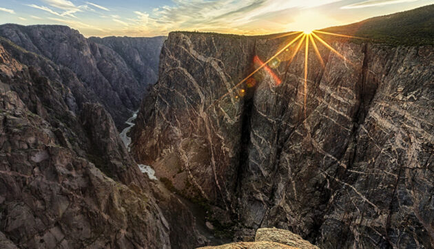
Stargazing Tip: Visit during a new moon for the best views of the Milky Way, especially at Chasm View or Dragon Point Overlook.
Tickets and Opening Hours
Opening Hours: The park is open 24/7, year-round. The South Rim Visitor Center operates daily from 8:00 AM to 5:00 PM (hours may vary in winter). The North Rim has no visitor center and is closed in winter.
Entrance Fees: Vehicle: $30 (7-day pass); Motorcycle: $25; Pedestrian/Cyclist: $15. Interagency Pass ($80 annually) covers all U.S. national parks and is cost-effective for multi-park trips. Free for holders of the Interagency Access Pass (for U.S. citizens with permanent disabilities).
Permits: Required for inner canyon routes (e.g., Gunnison Route) and backcountry camping. Obtain at the South Rim Visitor Center.
Note: No timed entry is required, but check for road closures or alerts on www.nps.gov before visiting.
What to See and Do
The park offers activities for all levels, from scenic drives to adrenaline-pumping adventures:
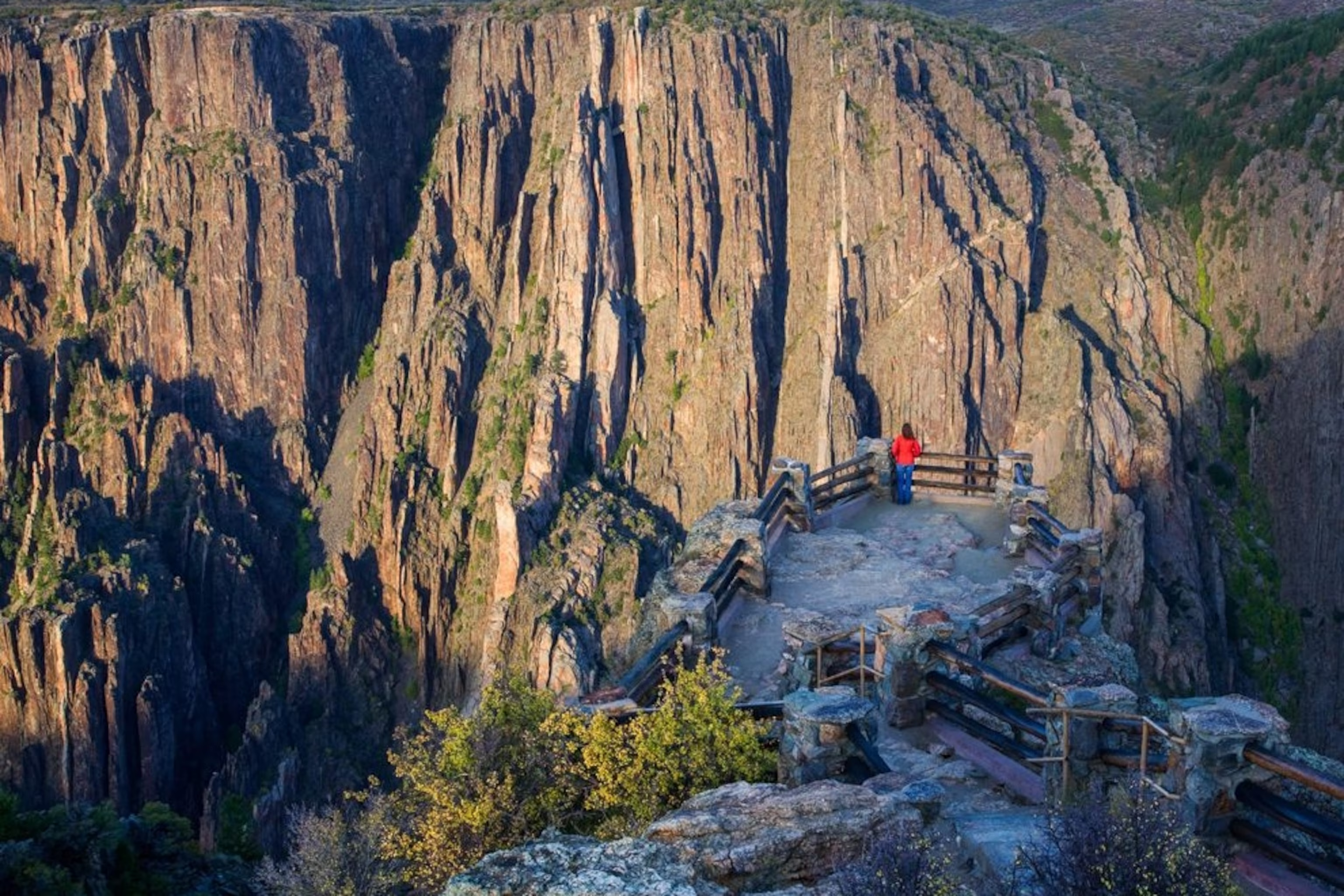
Scenic Drives: South Rim Road: A 7-mile paved route with 12 overlooks, including Gunnison Point, Chasm View, and Painted Wall. Allow 2–3 hours for stops and short walks.
North Rim Road: A 5-mile gravel road with 6 overlooks, offering intimate canyon views and fewer crowds. Favorites include Kneeling Camel Overlook.
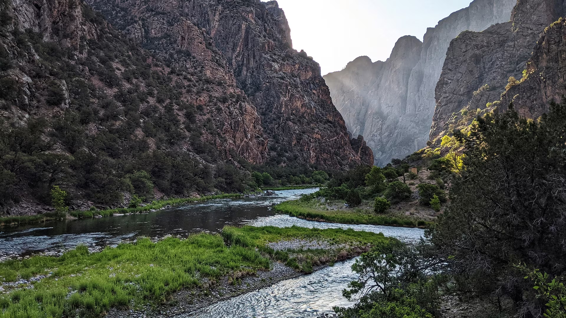
East Portal Road: A steep drive to the Gunnison River, ideal for fishing (Gold Medal waters) and picnicking.
Hiking: Warner Point Nature Trail (South Rim, 1.5 miles round trip, 423 ft elevation gain): A moderate hike with stunning views of the canyon and river. Family-friendly but with some steep sections.
Uplands Trail (South Rim, 1.5 miles round trip): An easy, flat trail through Gambel oaks, great for kids.
North Vista Trail (North Rim, 3–7 miles round trip): Leads to Exclamation Point (3 miles, easy) or Green Mountain (7 miles, strenuous) for panoramic views.
Gunnison Route (South Rim, 1.5 miles one-way, 1,800 ft descent): A challenging, permit-required inner canyon route with steep, unmarked terrain. For experienced hikers only.
Note: Inner canyon trails are rugged and require permits. Always carry a map, compass, or GPS, as trails are not well-marked.
Stargazing: As a Dark Sky Park, visit Chasm View Overlook or Dragon Point at night for spectacular Milky Way views. Bring a blanket and flashlight.
Rock Climbing and Kayaking: The park’s steep walls attract expert climbers, with 145 routes. The Gunnison River offers Class III–V rapids for experienced kayakers. Both require permits and advanced skills.
Ranger Programs: Free ranger-led talks on geology, wildlife, or history are offered in summer at the South Rim Visitor Center. Check schedules at the visitor center.
Wildlife Watching: Look for peregrine falcons, golden eagles, bighorn sheep, and mule deer. Bring binoculars for the best views.
Accessibility: The South Rim Visitor Center and several overlooks (e.g., Gunnison Point) are wheelchair-accessible. The South Rim Campground has two accessible sites. Audio guides are available for those with hearing impairments.
Where to Eat
Inside the Park: No food services are available. Bring your own food and water, as vault toilets are the only facilities (no traditional restrooms).
Nearby in Montrose (15 miles from South Rim): 1880 Tapas & Spirits: Offers Spanish-inspired small plates like shishito peppers, ideal for a post-park meal. The Dive: A brewpub with elevated dishes like buttermilk chicken sandwiches and local whiskeys.
Picnic Tip: Pack a picnic to enjoy at overlooks like Sunset View or the East Portal picnic area.
Where to Stay
Camping in the Park: South Rim Campground: Offers 88 sites (2 wheelchair-accessible), with tent and RV options (no hookups). Costs $16–$22/night. Book via www.recreation.gov.
North Rim Campground: Smaller, with 13 primitive sites. First-come, first-served. $16/night. East Portal Campground: Basic sites near the river, $16/night.
Hotels in Montrose: Island Acres Resort Motel: A retro-style motel with modern amenities, open May–October, from $100/night. Hampton Inn Montrose: Comfortable and close to the airport, from $120/night.
Crested Butte (30 miles from Gunnison): A trendy ski town with lodges and vacation rentals, ideal for combining with other regional attractions.
Booking Tip: Reserve campsites or hotels early for summer visits via Booking.com or www.recreation.gov.
Tips for a Great Visit
Prepare for Altitude: The park sits at 8,000–9,000 feet. Stay hydrated and pace yourself, especially on hikes. Bring Water and Sun Protection: Trails are exposed, and summer heat can be intense. Carry at least 1 liter of water per person for short hikes.
Check Road Conditions: South Rim Road may have construction; North Rim roads are gravel and closed in winter. Pet Policy: Dogs are allowed in parking lots and on paved roads (leashed) but not on trails or in the wilderness.
Combine Your Trip: Pair with nearby Curecanti National Recreation Area (Blue Mesa Reservoir) or Ouray (30 minutes away) for a fuller Colorado adventure.
Final Thoughts
Black Canyon of the Gunnison National Park is a geological masterpiece that offers awe-inspiring views, thrilling adventures, and a peaceful escape from crowded tourist destinations. Whether you’re driving along the South Rim, hiking to Exclamation Point, or stargazing under pristine skies, the park’s dramatic beauty and intimate scale will leave a lasting impression. Plan ahead, embrace the rugged terrain, and discover why this underrated gem is a must-visit in Colorado.
Happy travels!